Antique European Maps & Atlases England Dorset
95 Results
RARE Antique Map , W Pinnock , 1832 , , England , Dorset
$112.55$3.74 shippingCounty map of Dorsetshire England hand coloured c1860
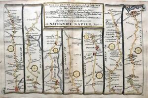
$11.26$6.88 shippingEXETER TO DORCHESTER ROAD MAP BY JOHN OGILBY REDUCED BY THOMAS GARDNER c1719
$68.79$10.01 shippingOrdnance Survey half inch layered map Portsmouth & Isle of Wight Sheet 38. 1914
$15.01$15.01 shippingc1895 county Map of Dorset England antique vintage Britannica 9th
$6.25$6.88 shippingVintage framed Hand Stitched Map Of England And Wales 20.5" x 16.5"
$39.95$19.16 shippingOrdnance Survey one inch Popular map of Sidmouth & Exmouth. 1927.
$4.250 bids$18.39 shippingEnding Wednesday at 11:38AM PDT2d 14hEXETER, PLYMOUTH, DARTMOUTH, antique road map, SENEX, OGILBY, pl 76-77, 1762
$41.27$11.88 shippingOXFORD TO SALISBURY & POOLE BY JOHN OGILBY REDUCED BY THOMAS GARDNER c1719
$62.54$10.01 shippingBRIDPORT, DORSET Original Street Plan, Dawson Original antique map 1832
$47.53$11.88 shippingDORSET, GUSSAGE SAINT ANDREW, TARRANT HINTON, original antique map, MOGG, 1817
$43.78$11.88 shippingvintage Retro Map , DORSET area , double Sided With Guide
$20.00$3.74 shippingDORSETSHIRE antique map from CAMDEN'S BRITANNIA, Robert Morden, published 1722
$137.58$11.88 shippingDEVON, SOMERSET, DORSET, Pl.13, original antique map, Cary, 1794
$33.77$11.88 shippingDORSET, ASKERWELL, BRIDPORT, CHARMOUTH, original antique road map, MOGG, 1817
$37.52$11.88 shippingWILTSHIRE DORSET ROAD MAP BY JOHN OGILBY REDUCED BY THOMAS GARDNER c1719
$68.79$10.01 shippingDORSET, WEST STOUR, MILBORNE PORT, SHERBORNE, original antique map, MOGG, 1817
$43.78$11.88 shippingNew ListingSmall Georgian County Map of Dorsetshire (c1820) Hand Coloured, Dorset, England
$12.490 bids$14.32 shippingEnding May 19 at 11:07AM PDT6d 14hNew ListingSmall Georgian County Map of Dorsetshire (c1824) Hand Coloured, Southern England
$12.490 bids$14.32 shippingEnding May 19 at 11:07AM PDT6d 14hWeymouth Yeovil Taunton 37 CLOTH Ordnance Survey Map Half Inch 1915 HILL SHADED
$13.75$20.07 shippingCounty of Dorset in England - Map Print -- 1907
$10.99$3.35 shippingDORSET, Robert Morden, original antique hand coloured map 1695
$206.37$23.14 shippingLONDON TO WEYMOUTH BASINGSTOKE BY JOHN OGILBY REDUCED BY THOMAS GARDNER c1719
$68.79$10.01 shippingSOMERSET, YEOVIL, EAST CHINNOCK, CREWKERNE, original antique map, MOGG, 1817
$43.78$11.88 shippingTHOMAS MOULE ORIGINAL HAND COLOURED ANTIQUE MAP OF DORSETSHIRE- CIRCA 1850
$75.05$18.76 shippingVINTAGE GEOGRAPHIA HANTS, WILTS & DORSET FOLD OUT MAP ON PAPER
$8.74$24.71 shippingENGLAND, DEVON, CORNWALL, HAMPSHIRE 'England sudlicher Theil', Von Reilly c.1790
$75.05$11.88 shippingOriginal antique map DEVON, EXETER, BIDEFORD, DORSET, LYME REGIS, Jefferys 1775
$43.78$11.88 shipping1904 Dorset (shire) large antique map. 119 years old. Lyme Regis, Dorchester.
$18.04$11.24 shipping2 watchingDEVON, HONITON, DORSET, STOCKLAND, CHARD, original antique map MOGG 1817
$43.78$11.88 shipping1951 Vintage Folding Map Hampshire & Dorset John Bartholomew 10" x 6.5"
$31.27$10.19 shipping3 x Old Antique Vintage Historical maps Dorset, England: 1600s & 1800's: Reprint
$15.01$10.01 shipping1841 Antique Map; Dorset by Thomas Moule
$25.00$6.50 shippingDORSET, Edward Weller Original Antique Map c1870
$43.78$11.88 shippingNew ListingSmall Georgian County Map of Dorsetshire (c1820) Hand Coloured, Southern England
$12.490 bids$14.32 shippingEnding May 19 at 11:07AM PDT6d 14h1830 Antique map - Dorset- from Gorton's Topographical Dictionary
$16.25$6.50 shippingSOMERSET, FROME, DORSET, WAREHAM, POOLE, Pl.14, original antique map, Cary, 1794
$36.27$11.88 shippingOXFORD, SALISBURY, COVENTRY, DERBY, antique road map, SENEX, 90-91, 1762
$35.02$11.88 shipping1736 Ogilby /Bowen The Road from London to Weymouth come Dorset
$50.00$8.70 shippingDorsetshire: antique map by Saxton & Kip, 1607 (1610 edition)
$218.88$25.02 shipping1823 ORIGINAL MAP UNITED KINGDOM ENGLAND WALES LONDON CAMBRIDGE LANCASTER YORK
$52.49$14.00 shippingDORSET DORSETSHIRE James Pigot Original Hand Coloured Antique County Map c1830
$81.30$23.14 shippingCarey's Map of Dorset, 1823
$62.52$15.63 shipping1951 Vintage Folding Map Weymouth England John Bartholomew 10" x 6.5"
$31.27$10.19 shippingDorset map by Sidney Hall fine detail engraved with hand colour c1830
$39.15$12.44 shippingDorset: antique map by George Bickham, 1754 (1st edition)
$212.63$25.02 shippingDorset Bartholomew Great Britain Contoured Paper Fold-Up Map 1962
$6.99$6.05 shippingBRISTOL TO WEYMOUTH, CAMBRIDGE TO COVENTRY, antique road map, SENEX, 64-65, 1762
$41.27$11.88 shippingOld Tudor Saxton 1500s Map of Dorset, England 1575 Antique Reprint Historical
$6.24$19.32 shippingBILL OF PORTLAND to THE NEEDLES, 1974 ADMIRALTY SEA CHART. No.2615
$13.76$23.71 shippingSOUTH WEST ENGLAND.Devon Cornwall Dorset Somerset.Telegraphs.JOHNSTON 1900 map
$33.77$10.01 shippingAntique Map of Dorsetshire by John Harrison 1789
$87.55$8.76 shipping1722 DORSET SHIRE, ENGLAND BY MORDEN, STUNNING COLOR 15 X 17 DOUBLE PAGE LINEN
$69.220 bidsEnding May 20 at 4:02PM PDT7d 19h$7.75 shippingOriginal antique road map DORSET, DEVON, WILTSHIRE, HAMPSHIRE, Paterson, 1785
$21.26$11.88 shippingVale of Severn Bartholomew Great Britain Contoured Paper Fold-Up Map 1961
$6.99$6.05 shippingHAMPSHIRE DORSET SUFFOLK NORFOLK DORCHESTER WELLS ROAD MAP BY JOHN SENEX c1757
$43.76$10.01 shippingOriginal antique map DORSET, DEVON, SALISBURY, CRANBOURNE, POOLE, Paterson 1785
$21.26$11.88 shippingOriginal antique county map DORSETSHIRE, DORSET, John Cary, 1828
$22.51$11.88 shipping